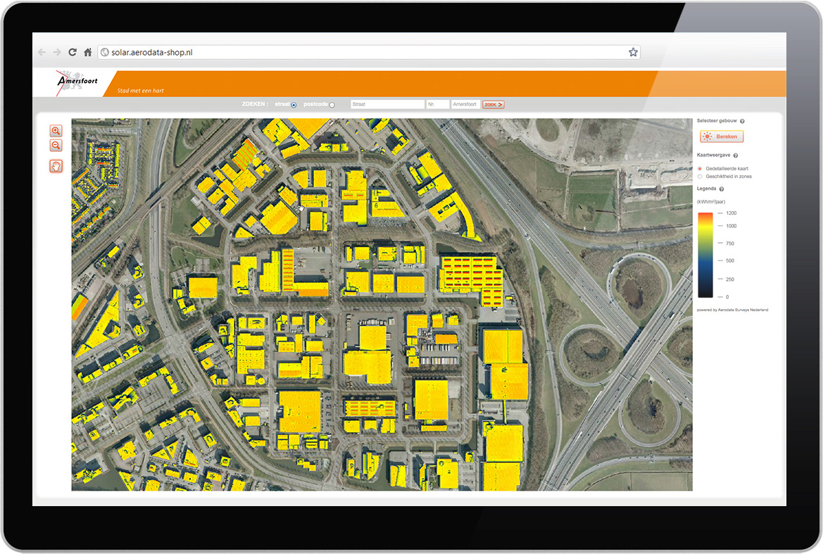
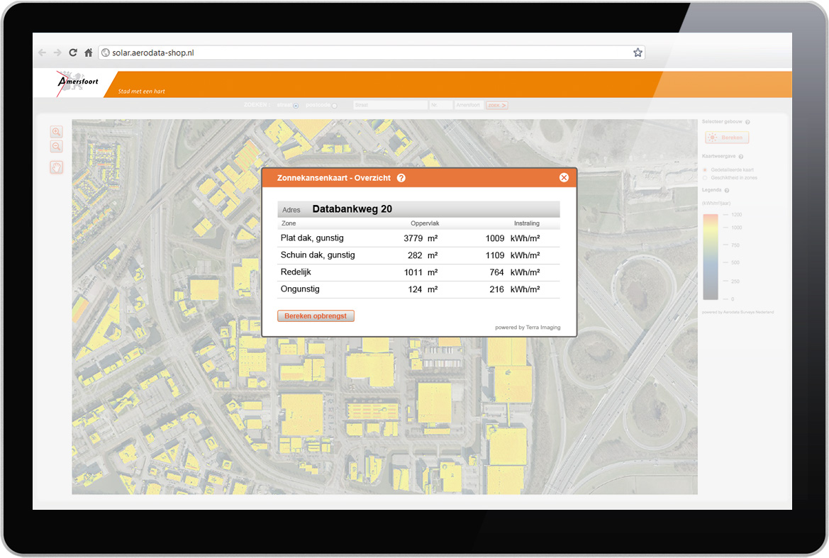
Combining aerial photography and a solar potential dataset, we were asked to develop a user friendly interface based on Orbit GIS’s protocol/API to allow inhabitants of Dutch towns to visualise the potential of their roofs for solar panels.
Technologies included a combination of datasets (shape file), EOS server, and Orbit GIS FlashMap component.